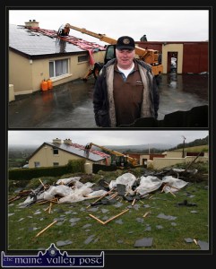
The general advice in dealing with the present Red Alert is simply Do Not Travel if you can avoid it and stay indoors if you can.
Be vigilant if you are out and about as all kinds of objects are likely to be caught and thrown around by the strong winds of tonight and tomorrow. Anyone who witnessed last February’s destructive storms won’t need reminding.
Charge your phone and whatever batteries you have and line up the candles and safe holders – just in case.
Check with your local schools as a Red Alert means that managements may close schools at their own discretion.
The forecast for tonight and the next couple of days is not to be taken lightly if we are to learn anything from the devastation caused by last year’s storms.
Met Éireann has issued the following:
Extremely windy or stormy, with some severe gusts at times. Widespread heavy rain this evening, with some local flooding. But more showery conditions will soon spread from the west. Some of the showers will be heavy, with some hail and thunder. Lowest temperatures later tonight of zero to +3 C., with frost and ice possible in sheltered places.
Tomorrow will be stormy for a time, with further severe gusts in places, but the winds will gradually moderate later in the day. Some bright spells, but heavy and prolonged showers also, with some sleet and possibly also a little hill snow in northern areas. Top temperatures 4 to 7 C., but feeling much colder in the wind.
On Thursday night, wintry showers will become confined to northern and western counties while the rest of the country becomes mainly dry and clear. Moderate to fresh, west to northwest winds will persist overnight but frost will occur widely inland.
Friday and Saturday will remain rather cold with fresh and gusty, west to northwest winds. It will be showery in general but the bulk of the showers, many wintry, will affect northern and western counties; elsewhere will have only isolated showers and clearer skies, by and large. Despite persistently breezy conditions, sharp frosts will occur at night and surface icing is likely to be a problem.
While Sunday next will continue quite cold, winds will ease down steadily and showers will tend to die out. A hard frost will set in for a time on Sunday night but rain, preceded by sleet and snow, is likely to develop in the south and west of the country later. A mixture of rain, sleet and snow will then spread countrywide during Monday, and there may be a risk of significant accumulations of snow further east and north eventually. Generally cold conditions seem set to persist well into next week, with further threats of snowfall from time to time.


